
![]()

Momepy is a library for quantitative analysis of urban form - urban morphometrics. It is built on top of GeoPandas, PySAL and networkX.
momepy stands for Morphological Measuring in Python
Some of the functionality that momepy offers:
Momepy aims to provide a wide range of tools for a systematic and exhaustive analysis of urban form. It can work with a wide range of elements, while focused on building footprints and street networks.
Momepy is a result of ongoing research of Urban Design Studies Unit (UDSU) supported by the Axel and Margaret Ax:son Johnson Foundation as a part of “The Urban Form Resilience Project” in partnership with University of Strathclyde in Glasgow, UK.
Comments, suggestions, feedback, and contributions, as well as bug reports, are very welcome.
Quick and easy getting started guide is part of the User Guide.
Documentation of momepy is available at docs.momepy.org.
User guide with examples of momepy usage is available at guide.momepy.org.
coverage = momepy.AreaRatio(tessellation, buildings, left_areas=tessellation.area,
                            right_areas='area', unique_id='uID')
tessellation['CAR'] = coverage.series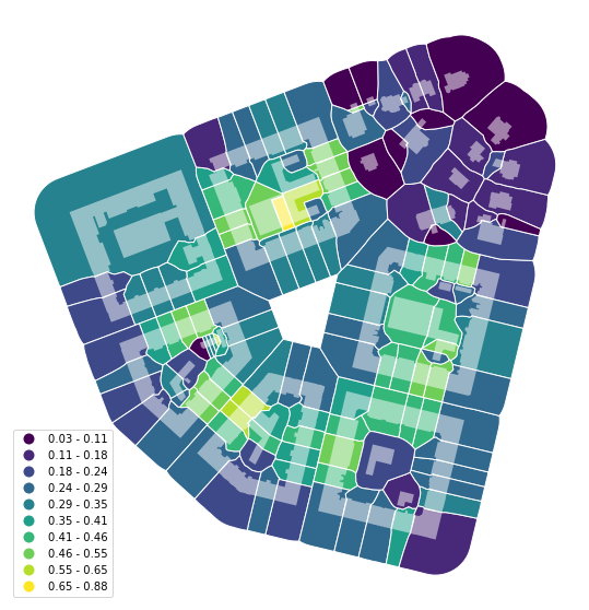
area_simpson = momepy.Simpson(tessellation, values='area',
                              spatial_weights=sw3,
                              unique_id='uID')
tessellation['area_simpson'] = area_simpson.series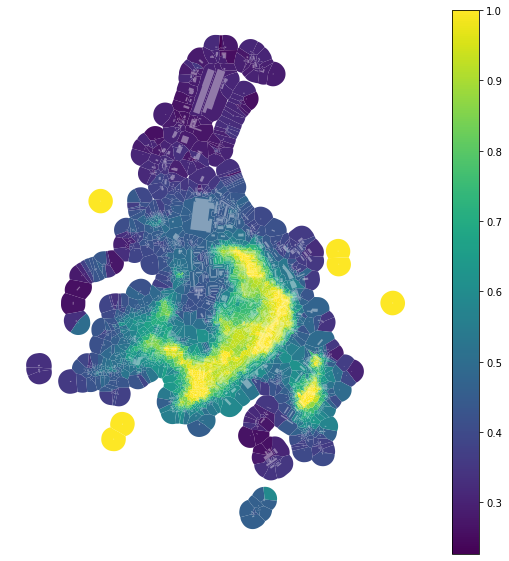
G = momepy.straightness_centrality(G)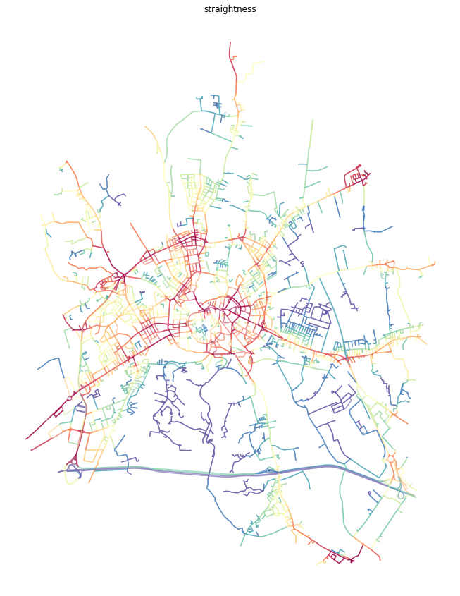
To cite momepy please use following software paper published in the JOSS.
Fleischmann, M. (2019) ‘momepy: Urban Morphology Measuring Toolkit’, Journal of Open Source Software, 4(43), p. 1807. doi: 10.21105/joss.01807.
BibTeX:
@article{fleischmann_2019,
    author={Fleischmann, Martin},
    title={momepy: Urban Morphology Measuring Toolkit},
    journal={Journal of Open Source Software},
    year={2019},
    volume={4},
    number={43},
    pages={1807},
    DOI={10.21105/joss.01807}
}You can install momepy using Conda from conda-forge (recommended):
conda install -c conda-forge momepyor from PyPI using pip:
pip install momepySee the installation instructions for detailed instructions. Momepy depends on python geospatial stack, which might cause some dependency issues.
Contributions of any kind to momepy are more than welcome. That does not mean new code only, but also improvements of documentation and user guide, additional tests (ideally filling the gaps in existing suite) or bug report or idea what could be added or done better.
All contributions should go through our GitHub repository. Bug reports, ideas or even questions should be raised by opening an issue on the GitHub tracker. Suggestions for changes in code or documentation should be submitted as a pull request. However, if you are not sure what to do, feel free to open an issue. All discussion will then take place on GitHub to keep the development of momepy transparent.
If you decide to contribute to the codebase, ensure that you are using an up-to-date master branch. The latest development version will always be there, including the documentation (powered by sphinx).
Details are available in the documentation.
If you have a question regarding momepy, feel free to open an issue on GitHub. Eventually, you can contact us on dev@momepy.org.
Copyright (c) 2018- Martin Fleischmann, University of Strathclyde, Urban Design Studies Unit